 Santo Domingo FIR (MDCS)
The Santo Domingo FIR covers the Dominican Republic and the surrounding waters.
| Airport | Name | Positions |
|---|---|---|
| MDSD | Las Américas International | Clearance, Ground, Tower, Approach |
| MDPC | Punta Cana International | Clearance, Ground, Ramp, Tower, Approach |
| MDST | Cibao International | Ground, Tower |
| MDPP | Gregorio Luperón International | Ground, Tower, Approach |
| MDJB | La Isabela International (El Higüero) | Ground, Tower |
| MDLR | La Romana International | Ground, Tower |
| MDCY | Samaná El Catey International | Ground, Tower |
| MDSI | San Isidro Air Base | Ground, Tower |
| MDBH | María Montez International | Ground, Tower |
| MDAB | Arroyo Barril | Tower |
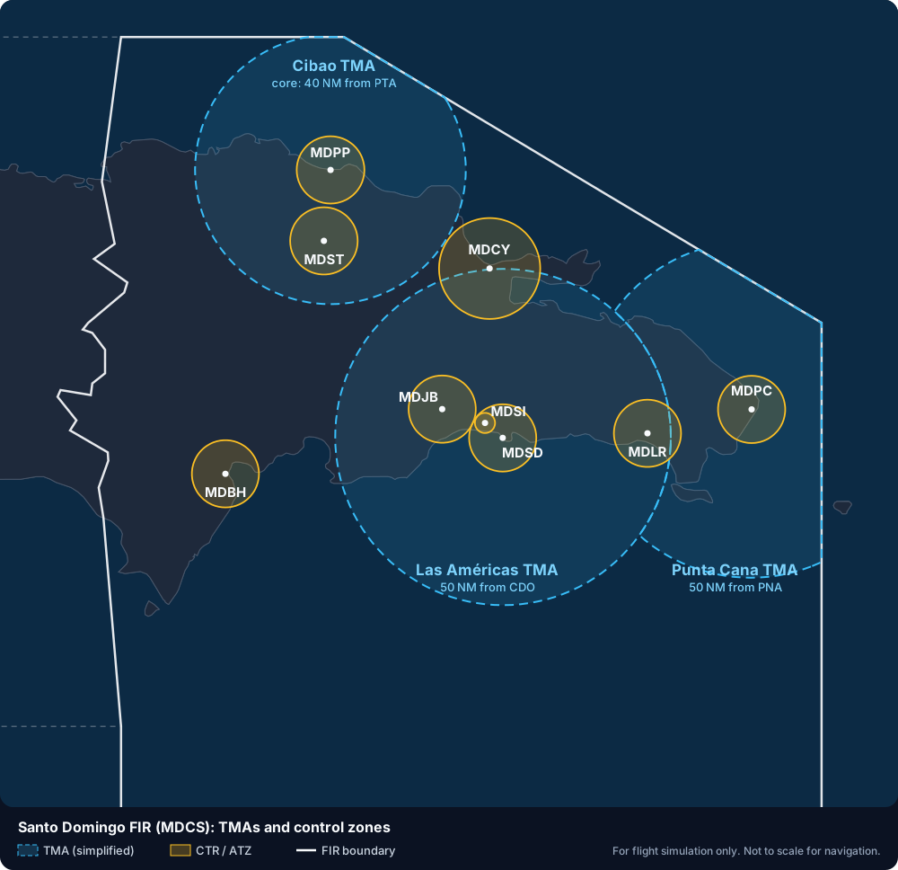
Simplified diagram from the Dominican Republic AIP (ENR 2.1, AD 2.17), with the permission of IDAC. The TMAs are shown as their basic circles; for exact limits, use the official TMA charts.
- Enroute: Santo Domingo Control
- Terminal: Las Americas Approach, Punta Cana Approach, Cibao Approach
The transition altitude in the Dominican Republic is 17,000 ft. Every aerodrome has a Class D control zone; see each airport's page.
Aerodrome information is summarised from the Dominican Republic AIP with the permission of IDAC.