 Port-au-Prince FIR (MTEG)
The Port-au-Prince FIR covers Haiti and the surrounding waters.
| Airport | Name | Positions |
|---|---|---|
| MTPP | Toussaint Louverture International | Tower, Approach |
| MTCH | Cap-Haïtien International | Tower |
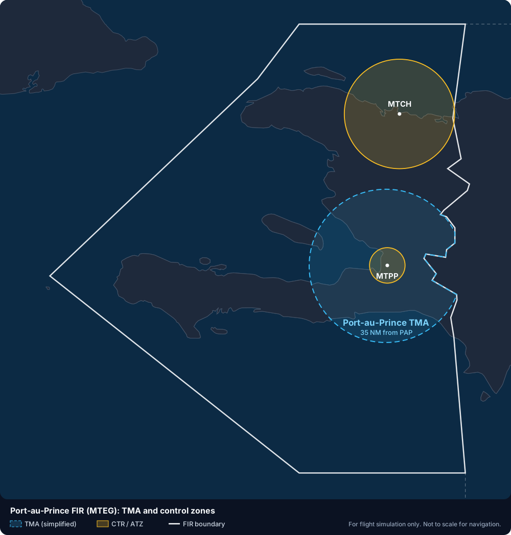
Simplified diagram from the AIP of Haiti (ENR 2.1, AD 2.17). For exact limits, use the official charts.
- Enroute: Port-au-Prince Control
- Terminal: Port-au-Prince Approach
- Transition altitude: 17,000 ft, as published in the AIP of Haiti (AD 2.17 for MTPP and MTCH).